Day Trips from Hanoi
A Half-Day Long Bien Ride: A Route With Walking Stops

About 17 minutes to read
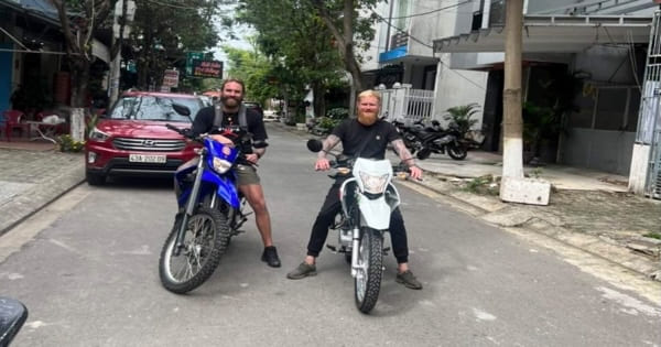
You have half a day in Hanoi, you want to move your legs, and you would rather not spend it dodging motorbikes in a line of tour buses. A ride around the Long Bien area solves all three problems at once. You start in the Old Quarter, walk through a street of murals, cycle across a 120-year-old bridge on lanes that are closed to cars, wander a wholesale market at the foot of the steel girders, and finish on a mid-river island where banana trees grow within sight of the skyline. The whole loop is short, flat, and stitched together with walking stops, so you are never pedalling for more than twenty minutes at a stretch. For a longer two-wheeled outing beyond this compact bicycle loop, compare our motorbike day trips from Hanoi.
This is not a fitness ride. It is a slow, stop-everywhere ride, and that is exactly what the area rewards. Here is how to do it properly.
Why the Long Bien Area Works for a Half-Day
Most of Hanoi’s famous sights sit inside a few crowded blocks. The Long Bien area sits just outside them, across a bridge that was the first steel crossing ever built over the Red River. Within a couple of kilometres of the bridge you get four completely different faces of the city in one compact loop:
- A piece of living colonial engineering. Long Bien Bridge was built between 1898 and 1902, originally named after Paul Doumer, the French Governor-General of Indochina. It still carries trains on the single track running down its spine, with lanes for motorbikes, bicycles, and pedestrians on either side. Cars are not allowed across, which is the single best reason to visit it on a bike.
- An open-air gallery. The old railway viaduct that leads up to the bridge is pierced by more than a hundred stone arches, and around two dozen of them were turned into painted murals in 2018 by Vietnamese and Korean artists. It is free, it takes thirty minutes, and you can only really see it on foot.
- A market that runs while the city sleeps. Long Bien wholesale market, a stone’s throw from the bridge, supplies a huge share of the capital’s fruit, vegetables, and flowers. It peaks in the middle of the night and winds down by sunrise, but the early hours of the morning still hum.
- Farmland in the middle of a river. The island locals call Bai Giua — the middle bank — is known to expats as Banana Island because of its plantations. Banana trees, vegetable plots, and kumquat and peach fields grow on silt fifteen minutes from the Old Quarter, and the paths between them are too narrow and too sandy to enjoy on anything but two wheels or two feet.
Because these stops are so close together, the ride never becomes a commute. You ride a little, park the bike, walk a lot, and repeat. That rhythm is the whole point of the route.
Before You Set Off
Getting a Bicycle
You do not need to book anything in advance. Rental shops cluster in the Old Quarter and around the approach roads to Long Bien Bridge. This route guide does not determine rider eligibility: check the bicycle, route restrictions and current traffic rules before setting off. Vietnam’s consolidated road-traffic safety law is the primary legal reference, and motorbike document requirements should not be copied across to a standard bicycle without checking the applicable vehicle category. Expect simple city bikes and single-speeds; helmets are not always included, so check before paying.
Typical pricing works roughly like this:
- Hourly rental: the first couple of hours usually cost somewhere in the range of 15,000 VND per hour at budget shops.
- Half-day and full-day rental: commonly from around 70,000 VND, with many shops charging 75,000–90,000 VND per day in low season and 130,000 VND or more during peak periods such as the weeks around Tet.
- Deposit: some shops take cash, others hold your passport or ID. Decide in advance what you are comfortable handing over, and photograph any existing scratches on the frame before you ride off.
For this route, anything with working brakes and a comfortable seat will do. The terrain is dead flat. What matters more is that you get an early start, because the two best walking stops on this loop — the market and the bridge — are both at their best before the day heats up. If you switch to a motorbike for a longer route, review our Hanoi riding safety guide before setting out.
Choosing Your Timing
| Time slot | What you get | Trade-offs |
|---|---|---|
| Early morning, roughly 5:30–9:30 | Cool air, soft light for photos, market still cleaning up, farmers watering their plots on the island | You must wake up in the dark; some mural arches are still in shadow |
| Late afternoon into sunset | Golden light on the bridge, city skyline glowing behind the banana trees, comfortable temperature after 4 pm | Market is finished for the day; traffic on the bridge lanes is heavier at rush hour |
| Middle of the day | Everything is open and easy to find | Heat, glare, and thin shade on the bridge; the island paths are dusty and bright |
If you can only pick one, take the early morning. The route is built around dawn: it is the only time the market, the bridge, and the island all make sense in a single half-day.
What to Bring
- Water, more than you think you need — there are few shops on the island paths.
- Sunscreen and a hat; the bridge and the island are almost entirely unshaded.
- Cash in small notes for water, fruit, and coffee. Card payment will not get you far here.
- A phone with a map downloaded offline; the island’s dirt paths are poorly signed, and getting a little lost is part of the fun only if you have battery left.
- Shoes you can walk in. Half of this route is on foot, and the island paths turn to soft sand in places.
The Route at a Glance
| Stop | What it is | On the bike or on foot | Rough time to allow |
|---|---|---|---|
| 1. Phung Hung Mural Street | Murals inside the arches of the old railway viaduct | Walking | 30–45 minutes |
| 2. Long Bien Bridge | The 1902 steel cantilever bridge over the Red River | Ride across, walk a section | 30–40 minutes |
| 3. Long Bien Market | Wholesale fruit, vegetable, and flower market at the bridge foot | Walking | 30–45 minutes |
| 4. Banana Island (Bai Giua) | Mid-river farmland: banana plantations, vegetable gardens, orchards | Riding between fields, walking the narrow paths | 60–90 minutes |
| 5. Return over the bridge | Second crossing, best light of the day in the late afternoon | Riding, with photo stops | 20–30 minutes |
Done with reasonable pauses, the whole thing fits comfortably in four to five hours. With a long breakfast stop on the island, it stretches toward a leisurely six.
Stop 1: Phung Hung Mural Street
Start at the western, Old Quarter end of the bridge, on Phung Hung Street. The street runs beneath the railway viaduct built between 1900 and 1902 to carry the line out to Long Bien station, and the arches of that viaduct — more than a hundred of them, though only about two dozen carry art — have become one of the most underrated walks in central Hanoi.
In 2018, to mark a quarter century of diplomatic relations between Vietnam and South Korea, teams of Vietnamese and Korean artists painted the arches with scenes of twentieth-century Hanoi: Hang Ma Street during the Mid-Autumn Festival, Trang Tien Department Store, street vendors, a schoolgirl on her way to class, the old tram system, women in ao dai. Each mural sits inside its own arch, so the street reads like a picture book you walk through one page at a time.
How to Walk It
- Park the bike where you can see it, or lock it if the shop gave you a lock. The street is short enough that you will not stray far.
- Walk the length of the murals slowly, arch by arch. Reading the small information panels under the paintings is what turns this from a photo backdrop into a history walk.
- Look up as well as forward. The viaduct itself is the attraction: rubble-stone arches of varying heights, still carrying trains on their way to and from the bridge.
- Keep an eye out for the ceramic mosaic panel near the north end of the street; it belongs to a separate city-wide mosaic project, so the style changes abruptly. Do not let that confuse you into thinking you have missed something.
The whole walk takes thirty to forty minutes, less if you only photograph and more if you actually read. Either way, it is the warm-up your legs need before the bridge.
Stop 2: Riding and Walking Long Bien Bridge
From Phung Hung, ride up the ramp and onto the bridge. This is the emotional centre of the whole route, and it deserves both of its modes: you should ride it once and walk part of it too.
The facts first. The bridge was built between 1898 and 1902 as the first steel crossing of the Red River, and at the time of its inauguration it was counted among the longest bridges in the world — its total length is usually given as about 2,290 metres. It is often linked to Gustave Eiffel’s company in guidebooks, and Hanoians fondly call it the “horizontal Eiffel Tower”, but if you look for the metal plate attached to the truss you will find it credits the builders Daydé & Pillé of Paris, with the dates 1899–1902. Either way, it was the largest construction project in Indochina at the time and it changed the city: for the first time, the railway could cross the Red River.
The layout is what makes it such a good ride. A single railway track runs down the middle, and the two side lanes carry everything else — motorbikes, bicycles, and pedestrians. No cars. The lanes are narrow, the steel rises over your head in repeating trusses, and the Red River spreads out underneath, its silted middle banks farmed in green rectangles that look stitched onto the water.
How to Enjoy It Without Being a Nuisance
- Ride on the right, ride steady. The side lanes are shared, and motorbikes pass close. Sudden swerves are more dangerous than slow ones.
- Never stop in the traffic lane for a photo. Use the wider bays and pull-in points; there are enough of them along the span.
- Walk the last section to the far bank, or walk back a hundred metres. On foot you notice things a bike ride erases: the rivets, the sag of the old spans, the vegetable barges under the bridge, the sound of the planks under motorbike wheels.
- Stay clear of the railway track. Trains still cross the bridge, though not often. When one comes, everything else stops, and it is worth watching from a safe distance — the whole bridge hums.
Take thirty to forty minutes here. If you see people clustered at the pull-in bays with cameras facing east, join them: the view down the river toward the newer bridges and back at the Old Quarter skyline is the defining image of this ride.
Stop 3: Long Bien Market
Come down the ramp on the eastern side and you are at Long Bien wholesale market, one of the largest of its kind in northern Vietnam. It supplies the capital with fruit, vegetables, seafood, and flowers trucked in from all over the country — and it runs on a clock of its own. The market peaks in the dead of night, with produce arriving from around midnight and the bulk of trading done before dawn. By mid-morning it is mostly crates, sweepers, and sellers catching a nap in their stalls.
That is why this stop belongs in the early hours of a morning ride. Arrive between six and eight and you catch the tail of the real thing: porters with bamboo shoulder poles moving the last boxes, fruit sellers sorting bruised from perfect, florists stacking unsold bunches, and the smell — ripe fruit, river mud, and noodle soup from the small stalls that feed the night shift.
Walking the Market Without Getting in the Way
- Park the bike outside the flow of trolleys and handcarts. Anything left in a loading lane will be moved for you, not kindly.
- Walk the outer aisles first to get the shape of the place, then dip into the fruit section.
- Buy what you want to eat on the island — mangoes, bananas, whatever is in season — and keep the purchases light.
- Ask before photographing faces at close range, as at any working market. Most porters will wave you off; most sellers of beautiful fruit stacks will happily pose with them.
If your ride starts late and you miss the market, do not force it. A quiet wholesale market at noon is a grim walk. Skip to the island and save the market for another visit at two in the morning — which, done once, is one of the great Hanoi experiences in its own right.
Stop 4: Banana Island — Bai Giua
From the market, ride south along the eastern bank until you find one of the small crossings onto the island in the middle of the river. Locals call it Bai Giua, the middle bank; expats call it Banana Island for the plantations that cover it. It sits directly opposite the Old Quarter, fifteen to thirty minutes from the centre, yet it feels like the Mekong Delta misfiled into a northern capital.
The island is farmland — real, working farmland on river silt. Banana plantations in dense rows, vegetable gardens watered by hand from channels, corn in the dry season, kumquat and peach fields that Hanoians visit by the vanload before Tet to buy their festival trees. The paths between the plots are narrow, sandy, and shaded, and in the morning you will share them with farmers cycling to their plots with hoes across the handlebars.
How to Explore It
Ride the wider paths, park the bike, and walk the narrow ones. The best parts of the island are precisely the parts where riding stops being fun: the lanes between banana rows barely wider than your handlebars, the orchid and bonsai corners where every plant has an owner who wants to tell you its age, the sandy riverside stretch where you can look straight back across the water at the bridge you crossed an hour ago.
- Keep to the established paths. Every plot is somebody’s livelihood; stepping through the rows to get a photo means stepping over someone’s crop.
- Say hello. A smile and “xin chao” opens more of the island than any map. Farmers here are used to tour groups rolling past at speed and visibly warm to anyone who slows down.
- Watch for dogs. Free-range and territorial around the houses near the landings.
- Plan around the river. The island exists because of silt, and in the wet season high water can flood the plots. In late summer the gardens are sometimes reduced to mud flats and the farmers wait for the water to drop. If the island is flooded out, shorten this stop and give the time back to the bridge.
- Eat here if you can. Small restaurants and drink stalls sit near the landings serving simple riverside food, and a late breakfast of fruit bought at the market, eaten at a plastic table with the bridge in view, is the meal this route was designed around.
Budget sixty to ninety minutes on the island. If you find yourself walking more than riding, you are doing it right.
Stop 5: Back Across the Bridge
Ride back out of the island, up onto the eastern approach, and cross Long Bien Bridge a second time. This is not a repeat — it is the payoff. The light is different, the traffic has thinned or warmed depending on your hour, and you now know what you are looking at. The trusses you admired as engineering on the way out read as history on the way back.
If you timed the ride for the late afternoon, this is one of the best sunset crossings in the city: the sun drops behind the Old Quarter skyline, the river turns pewter and then gold, and the silhouette of the bridge frames all of it. Park in a bay, stand at the rail, and let the motorbikes flow past while the sky does its work. Photographers who know Hanoi come here instead of the lake at sunset, and after one crossing you will understand why.
Costs at a Glance
| Item | Typical range | Notes |
|---|---|---|
| Bicycle rental, hourly | Around 15,000 VND per hour for the first hours at budget shops | Useful if you only want the bridge loop without the island |
| Bicycle rental, half-day or full-day | Roughly 70,000–130,000+ VND | Lower end in low season; rises around Tet and peak tourist months |
| Fruit at Long Bien Market | Cheap by Old Quarter standards | Wholesale prices spill over to walk-in buyers early in the morning |
| Drink or meal on the island | Modest local prices | Cash only; portions are generous |
| Mural street, bridge, island access | Free | All three stops cost nothing but legs |
Assuming you already have a place to stay in the centre, the entire half-day can be done for the price of the bike rental plus a couple of dollars of food and drink. It is one of the best-value blocks of time in the city.
Safety, Traffic, and Common Sense
Hanoi traffic has a reputation, and this route is the gentlest possible introduction to it, but a few habits matter:
- The bridge lanes are shared with motorbikes. They will pass close. Keep a steady line, stay right, and do not brake without warning.
- The Old Quarter stretch between your rental shop and the bridge is the busiest part of the whole route. Walk the bike for the first block if you are not confident, and join the flow only when you feel it.
- Trains come without much warning and everyone else on the bridge knows the drill before you do. When riders around you stop, stop.
- Leave your passport with the shop only if you are comfortable. Many shops accept a cash deposit instead; it is worth asking.
- Do not ride the island paths at speed. They are shared with farmers, dogs, and soft sand, and a fall here is a long, dusty way from a pharmacy.
- Check the weather and the season. The dry months from October to April are ideal. In the wettest weeks, the island may be partly under water and the riverside paths muddy — shift time to the mural street and the market instead.
FAQ
Can you actually cycle across Long Bien Bridge?
Yes. The bridge has a railway track in the middle and side lanes for motorbikes, bicycles, and pedestrians. Cars are not permitted, which makes it one of the few big-river crossings in Vietnam that genuinely belongs to two wheels. The lanes are narrow and shared, so ride steadily and stop only in the wider bays.
How long does the half-day route take?
Four to five hours at the relaxed pace the route deserves, including all the walking stops. You can compress it to three hours by shortening the island section, or stretch it toward six with a long breakfast on the riverbank.
Do I need to rent a bike, or can I do the route on foot?
You can walk the murals, the market, and the bridge without a bike, but the island is too big and too spread out to enjoy on foot alone. The bike is what lets you link all five stops without spending the day on tarmac. If you only want one stop on foot, do the bridge — but then you miss the farmland.
What is the best time of day to do the ride?
Early morning, starting around 5:30 to 6:00. The air is cool, the light is soft, the market is still finishing its night, and the island farmers are watering their plots. The second-best window is late afternoon into sunset, when the return crossing over the bridge becomes the highlight of the day.
Is the route suitable for children or nervous riders?
The bridge lanes are shared with motorbikes, so it is not for a child’s first-ever ride in traffic. That said, plenty of families do this route: the distances are short, the terrain is flat, and the island paths are almost car- and motorbike-free. Judge it by the rider, not by the route.
Do trains still cross the bridge?
Yes, though not often. The single track down the middle is still in use, and a train crossing — the bridge shaking gently while everything on two wheels pulls over and waits — is one of the memorable moments of the ride. Keep off the track and stay near the bays whenever you stop.
Is it safe to walk on Banana Island’s paths?
The paths themselves are quiet and safe, but they are working farmland: expect dogs near houses, soft sand near the water, and no shade in the middle of the day. Stay on established paths, keep to the riverside eating spots if you want a rest, and keep your phone charged for navigation, because the paths are poorly signed and it is easy to add an unplanned kilometre.
Is the Eiffel story about the bridge true?
It is complicated, and honestly part of the charm. The bridge is popularly linked to Gustave Eiffel’s firm and nicknamed the “horizontal Eiffel Tower”, but the metal plate on the truss credits Daydé & Pillé of Paris, the contractor that built it between 1899 and 1902. Enjoy the legend, read the plaque, and decide for yourself.
What should I do if the river is flooding?
In the wettest weeks of the summer the middle bank floods and the island’s gardens can be underwater or reduced to mud. Check with your rental shop or any riverside local that morning, and if the island is out, give the extra time to a slower bridge crossing and a longer wander through the murals and the market approach — the route still works without its greenest stop.